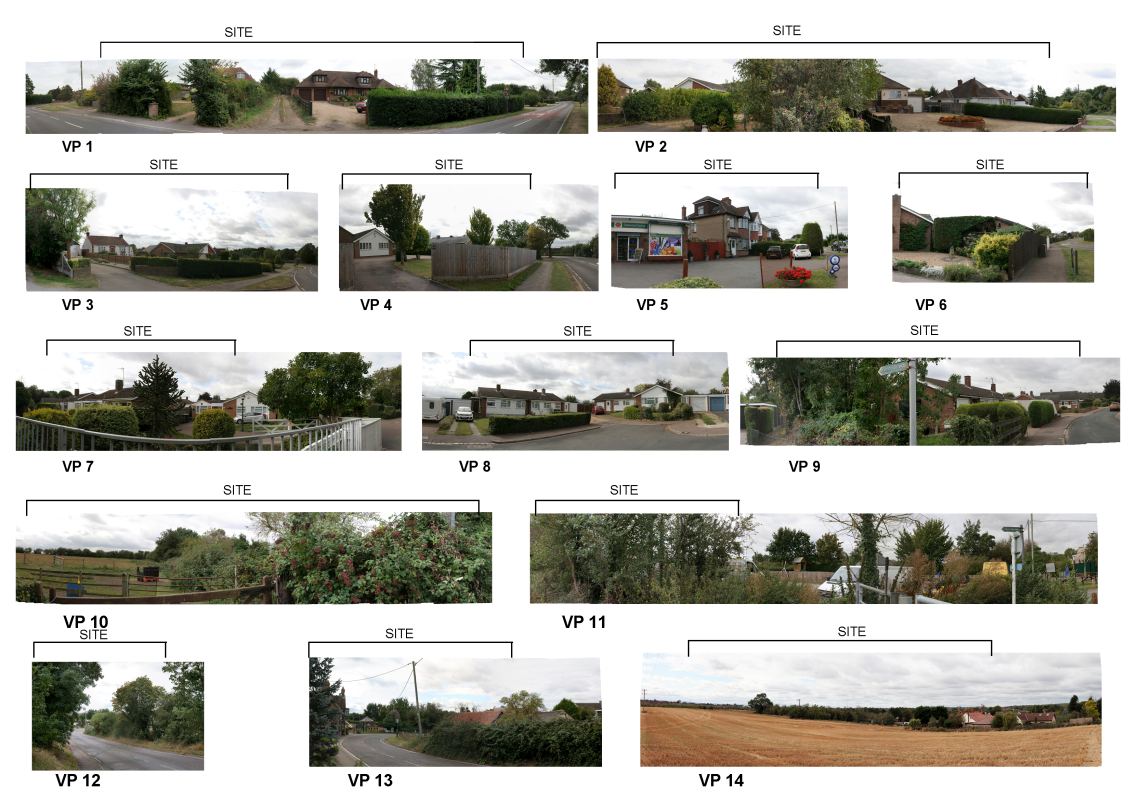
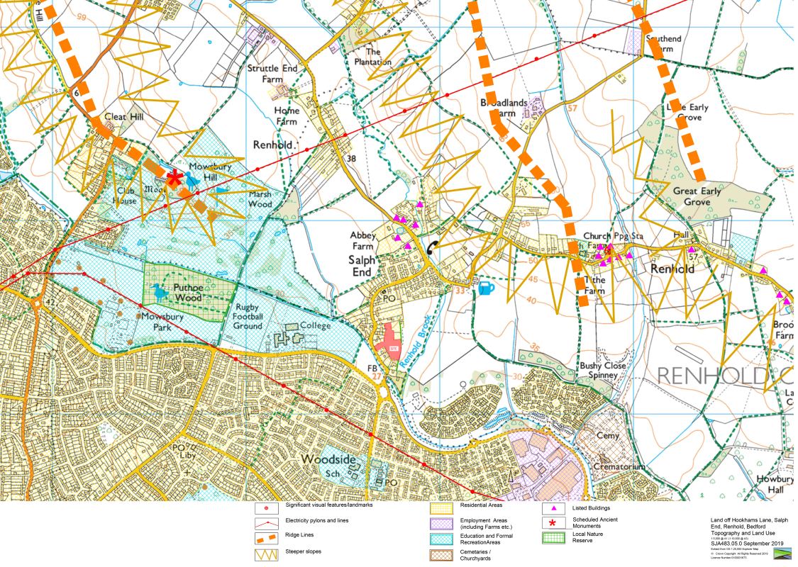
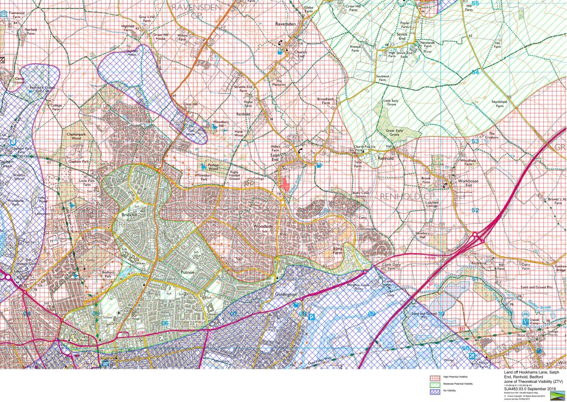
Hookhams Lane, Renhold
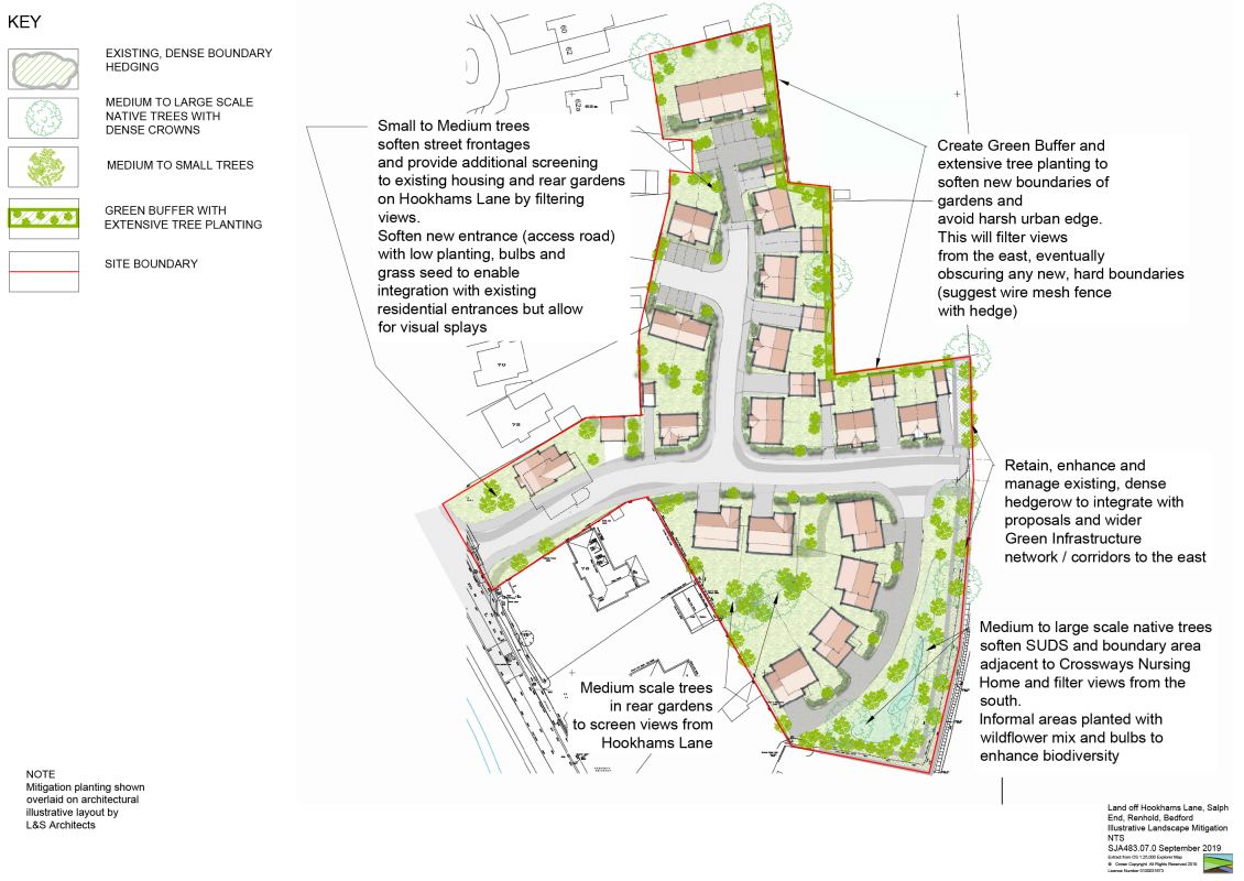
A development of up to 28 dwellings toinclude affordable housing, north of Bedford.
The site is rough grassland and scrub with areas of paddock land. The site is not in productive use or part of a larger field layout.
It is currently designated as lying just outside the Bedford Urban Area and the settlement boundary of Salph End and lies within the Bedford Northern Fringe to the northeast of the town. The site is Open Countryside.
In addition, areas near the site have a variety of landscape designations including Putnoe Wood Local Nature Reserve, Green Infrastructure Network Opportunity Zone and Bedford Northern Fringes, Mowsbury Hillfort, and a Scheduled Monument.